Redefining Mobile Mapping

Professional mobile mapping solutions for every environment.
Built for surveying, infrastructure and reality capture.

Drone

Why the MS-96

Continuum of Performance

Continuum of Performance

Continuum of Performance

Everything you need to know about the MS-96. Starting with the four pillars that set it apart

Survey-Grade Accuracy

  1. PRECISION

Capture precise, georeferenced point clouds ready for engineering, surveying, and construction workflows.

Sub-Centimeter Precision

Survey-Ready Deliverables

Built For Every Mission

  1. MODULARITY

Deploy the same system as a backpack, vehicle-mounted or front-pack configuration depending on the mission.

Backpack configuration

Vehicle-Mounted Deployment

Service Image
Service Image

Total Data Ownership

4. OWNERSHIP

No subscriptions. No scan credits. No cloud lock-in. Your data stays yours.

No Recurring Costs

Full Data Ownership

Service Image

Faster Field Operations

1. SPEED

Cover more ground in less time and reduce costly revisits thanks to high-speed mobile mapping.

Reduced Field Time

Fewer Site Revisits
Service Image

2

Drone

1

3

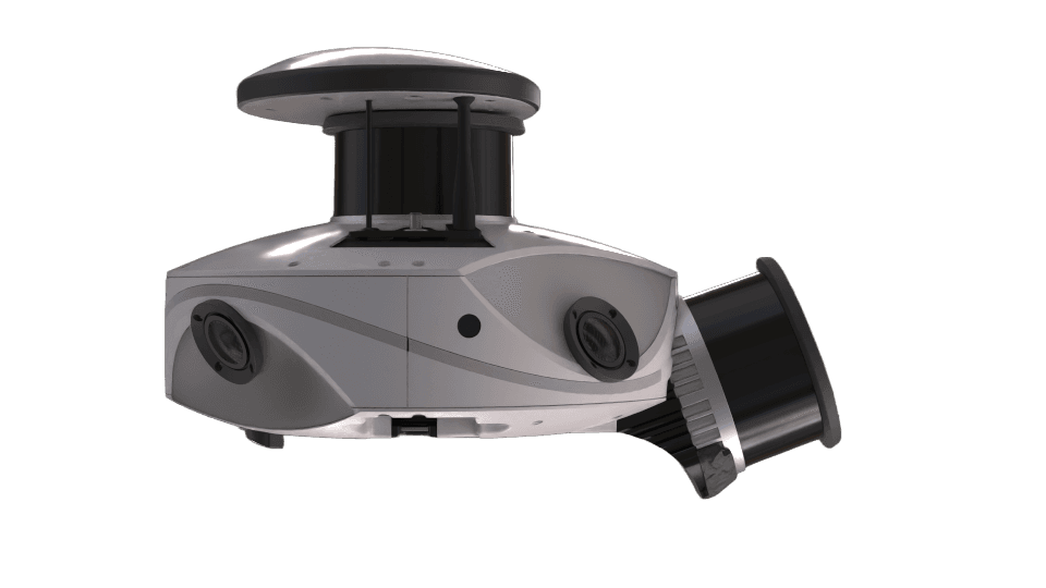
The MS-96 is a high-performance mobile mapping system designed to capture accurate, high-density data in any environment. Built for efficiency and interoperability, it gives you full control over your data. From capture to deliverables, without being locked into a specific ecosystem.

How It Works

From idea to
A Complete Mobile Mapping Workflow

Step 1
Scan

Scan

Capture high-density 3D data in motion. Indoor, outdoor, in motion.

Capture high-density 3D data in motion. Indoor, outdoor, in motion.

Step 1

Scan

Capture high-density 3D data in motion. Indoor, outdoor, in motion.

Step 2
Operate

Operate

Capture high-density 3D data in motion. Indoor, outdoor, in motion.

Capture high-density 3D data in motion. Indoor, outdoor, in motion.

Step 2

Operate

Capture high-density 3D data in motion. Indoor, outdoor, in motion.

Step 3
Deliver

Deliver

Capture high-density 3D data in motion. Indoor, outdoor, in motion.

Capture high-density 3D data in motion. Indoor, outdoor, in motion.

Step 3

Deliver

Capture high-density 3D data in motion. Indoor, outdoor, in motion.

WE ARE OFTEN ASKED

VIAMETRIS solutions are trusted by professionals in surveying, engineering, construction, transportation, utilities, mining, forestry, and infrastructure asset management.
Request a live demonstration or contact one of our authorized partners to see the MS-96 in action. If you can't attend a demo, we also provide videos of the MS-96 and real-world point cloud results upon request.
The MS-96 captures survey-grade point clouds and imagery in a wide range of environments, including buildings, roads, railways, industrial sites, tunnels, forests, and urban areas.
VIAMETRIS works with a growing network of authorized distributors and partners across Europe, North America, Asia, the Middle East, and beyond.

Supported by a global partner network

  • Logo
  • Logo
  • Logo
  • Logo
  • Logo
  • Logo

Check Our Our Resources